Lamayuru to Padum Trek
Duraton : 3-day drive, 12-day trek-
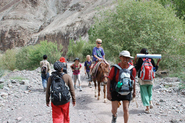
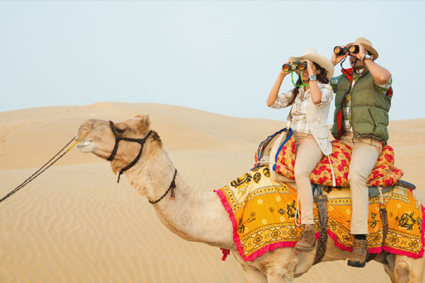
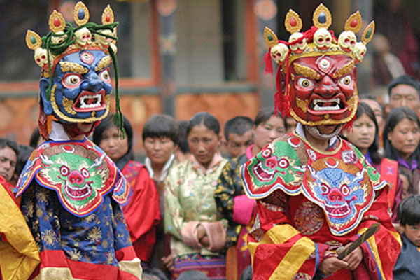
Best Season Mid May to September Duration 3-day drive, 12-day trek Grade Moderate to Strenuous Highlights This trek goes into the hidden kingdom of Zanskar. Starting from the ancient monastery at Lamayuru, perched on a precipice, the trek offers close encounters with Zanskari life, passing interesting villages with their little gompas on practically every day of the trek. The route also takes in eight high passes and, depending on the time of the year, up to a dozen river crossings. Ladakh and Zanskar form the western edge of the Tibetan plateau and are popularly known as "Little Tibet" due to the similarity of the culture and the high altitude desert landscape. Politically, this region forms a part of India, though the religious head is still the Dalai Lama. The flora and fauna is also similar to Tibet and is quite distinct from the rest of the Himalayas. The region, being beyond the reach of the monsoon, is dry with sparse vegetation. Willow groves and poplars are found near villages. Bushes of eidelberry, wild strawberry and sage brush are also common. The fauna includes marmots, blue sheep and ibex and an occasional snow leopard, besides many birds of prey.
You will be met on arrival at Leh airport and transfer to hotel. Leh is situated at an altitude of 3500 M above sea level and need to acclimatize. Suggested to have a complete rest at the hotel.
Evening you will be taken at the top of the hill at Shanti Stupa offers an incredible view of Leh valley. Have some time at this place and retrace back to Leh by visiting Shankar Gompa enroute and Leh market. Overnight at hotel in Leh.
Leh Palace : This nine-storey dun-coloured palace took shape under 17th-century king Sengge Namgyal. Essentially it has been unoccupied since the Ladakhi royals were stripped of power and shuffled off to Stok in 1846. Located at the top of a small hill in main Leh market on walkable distance. Offers a magnificient view of Leh city at the roof top
Shey Palace : Thikse & Hemis monastery : by driving in the east of Leh city must visit Shey Palace and one of the most picturesque monastery called Thiske. Hemis Monastery is a Tibetan Buddhist monastery of the Drukpa Lineage, Situated 45 km from Leh by crossing Indus river and steep drive to reach at. This monastery was re-established in 1672 by the Ladakhi king Sengge Namgyal.
Drive five hours on the Leh/Srinagar Highway as far as Lamayuru, a splash of green against the stark desert with its charming village and a centuries old gompa. The afternoon is spent exploring the village and gompa. Camp is set on a forested river bank below the village.
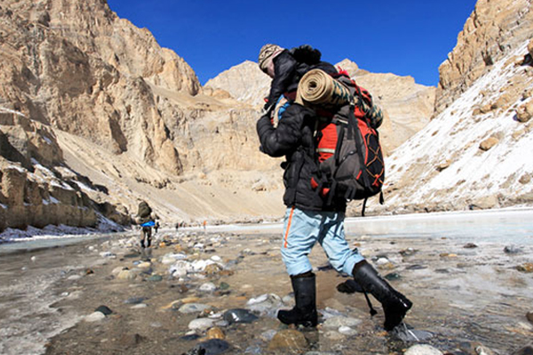
The trek starts after breakfast, passing through crumbling gorges. The path gradually ascends southwards, to the Prinkiti la (12,221 ft/3,726 m), reached in about an hour. Descend along a dry narrow gorge to the valley of Shillakong, through apricot orchards and beautiful willow groves, via the village of Shilla and on to the village of Wanla, dominated by its red-hued gompa.
Follow the river on the true right bank. The trail goes through many villages for about two hours to the village of Penjilla, where a small stream is crossed. Following the right bank again, continue through a narrow gorge to a major ford, crossing over a natural rock bridge to the true left bank. From here follow the stream flowing from the west up to the village of Hanupatta. The camp is set past the village on the banks of the stream.
The first of the high passes on the route is crossed today. After an hour's walk along the true left bank of the stream, cross a bridge and climb steeply for about two hours to the Sirsir la (15,744 ft/4,800 m). A long descent leads to a large chorten (a pagoda-like structure to consecrate the dead) and on to the village of Photoksar. The camp is set on the grassland next to the river before the village.
The day starts with an hour-long steep climb to the Bumiktse la (13,776 ft/4,200 m) and a beautiful view back towards Photoksar. After a short descent and an easy ford, the path climbs gradually up to the base of Singi La, another four hours' walk. After a short, steep ascent to the top (16,400 ft/5000 m) and an equally steep descent, camp is set near the stream flowing down from Shingi La. The broad valley before crossing the Singi La is full of wild flowers and russet coloured marmots can also be seen in plenty.
The trail starts with a level walk through rocky countryside up to the Kiupa la (12,628 ft/3,850 m) and then a very steep descent towards the village of Gongma located on a plateau surrounded by barley fields. After crossing the stream at the base of the pass, a long steep ascent leads to the Murgum la (13,448 ft/4,100 m) past the village of Skiumpata from where another half hour of gradual descent leads to Lingshet. Overnight camping.
Lingshet gompa is amongst the largest in the region and holds sway over a vast area. It is extremely picturesque, rising layer upon layer on the mountainside, looking down on the basin-like valley of Lingshet which is totally covered with green fields and dotted with beautiful Ladakhi houses all around.
During late summer and autumn the rooftops are piled up with bushes and brushwood to be used as kindling in the coming winter. These turn a deep shade of brown drying out in the sun, adding dramatically to the colour of the countryside. The day is spent exploring the gompa and the village.
After going through the village, the path climbs to a low saddle, traverses the mountainside, climbs up another small pass and within two hours the base of Hanuma-La is reached. A steep climb of about two to three hours to the top (15,416 ft/4,700 m) offers breathtaking views of the Lingshet village and gompa. A gradual descent along the mountainside leads to a fork in the valley. The path now goes along the stream flowing down the valley from the north-east. Campsite is within two to three hours of the pass, among the sheepfolds of Snertse on the true left bank of the stream.
A traverse of the mountainside after crossing the stream and a steep descent of around 1,600 feet (500 m) leads to the Oma-chu river. After crossing a wooden bridge, climb steeply for about two hours to reach the top of the Parfi la (12,792 ft/3,900 m). From here, the Zanskar river flowing north is visible and a steep descent leads to its shores. Follow the river south on the true left bank to the campsite at Hanumil about 3 hours from the top of the pass. Camp is set under the willow trees a little before the two-house village.
The trail continues on the left bank, sometimes across the morainic plateau, to the village of Pidmu, reached in about two hours. A bridge is crossed after the village and a long but easy walk leads to Pishu. Across the gradually widening valley can be seen the village of Zangla, home of the king who once held sway over a large part of Zanskar, including Padum, the present capital. Camp is set below the village on an attractive meadow.
The trail follows the Zanskar river, across an often hot and dusty plain to the village of Rinam. Leave the village below and continue south to a point where the valley opens out on to the wide plain of Padum.
The Tsarap river flowing down north from the Zanskar valley and the Doda river flowing south from the Pensi-la meet here to form the Zanskar, which flows north-northeast to join the Indus at Nimo on the Srinagar-Leh Highway.
The path goes along the mountainside on the left bank of the Doda river up to the village and gompa at Karsha. Camp is set below the village on a lovely meadow by the river.
The Karsha village and gompa complex, spread out on the mountainside, can be seen from the campsite. It takes an hour and a half through fields to reach the main gompa buildings located at the summit. This is the biggest gompa in Zanskar, dating back to the 15th century and houses a fine collection of ancient treasures.
Padum, the capital of Zanskar is located two to three hours walk away, if the bridge at Karsha is crossable. If not, one has to traverse the mountainside up to the Tungri bridge on the Doda river and go via Sani gompa to Padum; the round-trip journey takes up to 10 hours.
The drive goes up the Doda valley to the Pensi la (14,400 ft/4,389 m) with spectacular views of the Nun and Kun massif on clear days. The road then descends to the plain of Rangdum. The gompa, located near the centre of a knobby hill, is visible from far. Camp is set up half an hour's walk from the gompa.
Drive along the Suru valley passing below the Nun Kun peaks through the villages of Parkachik and Panikhar. A distinct change in culture, from Buddhist to Muslim, is discernible as one approaches Kargil. Overnight at a simple hotel.
Depart early in the morning for the return drive to Leh.
After breakfast you will be transferred to the airport in time to board flight for onward destination